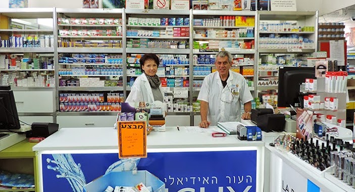
Pharmacy nearby Super-Pharm
Coronavirus disease (COVID-19) Situation
confirmed cases
4841772
deaths
12707
Israel
Pharmacy nearby Super-Pharm
Super-Pharm
25, Sokolov Street, Herzliya, IL Israel
contacts phone
:
+972 77-888-0260
website:
www.super-pharm.co.il
Latitude:
32.1672884
, Longitude:
34.8412628
larger map & directions
read more
nearest Pharmacy
סופר-פארם סוקולוב הרצליה
סוקולוב 25, הרצליה
Pharmacy
read more
113 m
Maccabi Pharm
Sokolov Street 17, Herzliya
Pharmacy
read more
113 m
מכבי פארם
סוקולוב 17, הרצליה
Pharmacy
read more
117 m
לב הרצליה
הרצליה
Pharmacy
read more
117 m
Lev Haiir
Herzliya
Pharmacy
read more
424 m
כללית
שדרות בן גוריון, הרצליה
Pharmacy
read more
424 m
כללית בית מרקחת
שדרות בן גוריון, הרצליה
Pharmacy
read more
424 m
Поликлиника Клалит
Ben Gurion Boulevard, Herzliya
Pharmacy
read more
432 m
New Pharm
Ben Gurion Boulevard 19, Herzliya
Pharmacy
read more
432 m
ניו פארם
שדרות בן גוריון 19, הרצליה
Pharmacy
read more
1.316 km
clalit
ביל"ו 9, הרצליה
Pharmacy
read more
1.316 km
Clalit
Bilu Street 9, Herzliya
Pharmacy
read more
1.719 km
Супер-Фарм
Shiv'at Hakohavim Boulevard 8, Herzliya
Pharmacy
read more
1.777 km
Super-Pharm
Tsamarot Street 2, Herzliya
Pharmacy
read more
2.172 km
Супер-Фарм
Ahuza Street 267, Ra'anana
Pharmacy
read more
2.172 km
סופר פארם פארק מול
אחוזה 267, רעננה
Pharmacy
read more
2.324 km
Поликлиника Клалит
Sokolov Street 74, Ramat Hasharon
Pharmacy
read more
2.425 km
ניו פארם גמלא
שמחה הולצברג, רעננה
Pharmacy
read more
2.425 km
New Pharm
Simha Holtsberg Street, Ra'anana
Pharmacy
read more
2.673 km
Super-Pharm
Ussishkin Street 62, Ramat Hasharon
Pharmacy
read more
2.865 km
בית מרקחת מונטי רמת השרון
Ussishkin Street 41, Ramat Hasharon
Pharmacy
read more
2.91 km
בית מרקחת אחוזה
אחוזה 198, רעננה
Pharmacy
read more
2.91 km
Аптека Ахуза
Ahuza Street 198, Ra'anana
Pharmacy
read more
3.057 km
Arza
Ostrovsky Street, Ra'anana
Pharmacy
read more
3.366 km
Поликлиника Клалит
Ha-Po'el Street 22, Herzliya
Pharmacy
read more
📑
all categories
Accounting
Administrative area level 1
Administrative area level 2
Airport
Amusement park
Aquarium
Art gallery
Atm
Bakery
Bank
Bar
Beauty salon
Bicycle store
Book store
Bowling alley
Bus station
Cafe
Campground
Car dealer
Car rental
Car repair
Car wash
Casino
Cemetery
Church
City hall
Clothing store
Colloquial area
Convenience store
Country
Courthouse
Dentist
Department store
Doctor
Electrician
Electronics store
Embassy
Establishment
Finance
Fire station
Florist
Food
Funeral home
Furniture store
Gas station
General contractor
Grocery or supermarket
Gym
Hair care
Hardware store
Health
Hindu Temple
Home goods store
Hospital
Insurance agency
Intersection
Jewelry store
Laundry
Lawyer
Library
Light rail station
Liquor store
Local government office
Locality
Locksmith
Lodging
Meal delivery
Meal takeaway
Mosque
Movie rental
Movie theater
Moving company
Museum
Natural feature
Neighborhood
Night club
Painter
Park
Parking
Pet store
Pharmacy
Physiotherapist
Place of worship
Plumber
Point of interest
Police
Political
Post office
Premise
Real estate agency
Restaurant
Roofing contractor
Route
Rv park, camping
School
Shoe store
Shopping mall
Spa
Stadium
Storage
Store
Subpremise
Subway station
Supermarket
Synagogue
Taxi stand
Train station
Transit station
Travel agency
University
Veterinary care
Zoo
administrative area level 3
administrative area level 4
sublocality level 1
↑