Pharmacy nearby Super-Pharm
Israel
Pharmacy nearby Super-Pharm
Super-Pharm
אל קודס, באקה אל-ע'רביה, חדרה, IL Israel
contacts phone
:
+972 77-888-2180
website:
www.super-pharm.co.il
Latitude:
32.4152762
, Longitude:
35.0458806
larger map & directions
read more
nearest Pharmacy
סופר פארם
אל קודס פינת ביר-באקה, באקה אל-ע'רביה
Pharmacy
read more
Super-Pharm
אל קודס פינת ביר-באקה, Baqa al-Gharbiyye
Pharmacy
read more
Супер-Фарм
אל קודס פינת ביר-באקה, Baqa al-Gharbiyye
Pharmacy
read more
Супер-Фарм
אל קודס, באקה אל-ע'רביה
Pharmacy
read more
37 m
סופר-פארם באקה אל גרביה
אל קודס פינת ביר באקה, Baqa al-Gharbiyye
Pharmacy
read more
539 m
Baka HaMerkaz
Baqa al-Gharbiyye
Pharmacy
read more
1.011 km
איווה פארם
אלרומאן, באקה אל-ע'רביה
Pharmacy
read more
2.096 km
Поликлиника Клалит
באקה ג'ת, סמוך למרפאת הכללית/משטרה
Pharmacy
read more
2.096 km
כללית בית מרקחת
באקה ג'ת, סמוך למרפאת הכללית/משטרה
Pharmacy
read more
9.374 km
Поликлиника Леумит
Gafnovitch Street 5, Hadera
Pharmacy
read more
9.433 km
כללית בית מרקחת
הגליל, רח' הנחילות 4 פינת רח' הגליל, פרדס חנה כרכור
Pharmacy
read more
9.465 km
Super-Pharm
מרכז מסחרי, גן שמואל
Pharmacy
read more
10.161 km
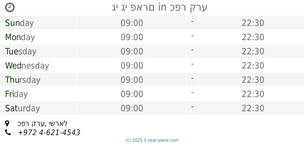
גי גי פארם
כפר קרע
Pharmacy
read more
10.214 km
Поликлиника Клалит
1 רחוב ראשי, ערערה
Pharmacy
read more
11.206 km
Супер-Фарм
מרכז MIXX, רח' צה"ל 35, חדרה
Pharmacy
read more
11.807 km
Super-Pharm
Sderot Rothschild 40, Hadera
Pharmacy
read more
12.136 km
בית מרקחת מאוחדת
חדרה
Pharmacy
read more
12.529 km
Доктор Кей
Herbert Samuel St. 37, חדרה
Pharmacy
read more
14.447 km
ניו פארם
העוגן
Pharmacy
read more
15.042 km
הריבוע הירוק
דרך המסילה 21, בנימינה גבעת עדה
Pharmacy
read more
15.311 km
דר פארם
عز الدين القسام أم الفحم IL 30010, עז א דין אל קסאם, אום אל-פחם
Pharmacy
read more
15.338 km
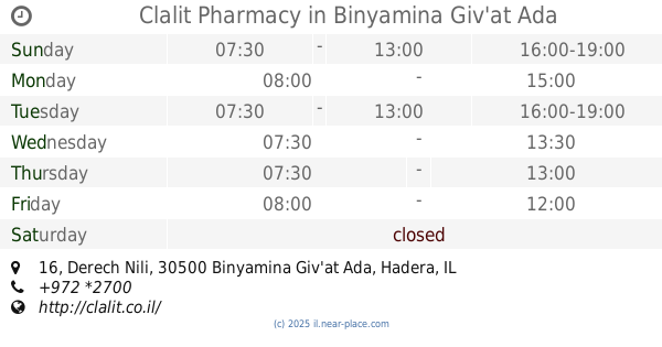
Clalit Pharmacy
Derech Nili 16, Binyamina-Giv'at Ada
Pharmacy
read more
15.972 km
בית מרקחת דיווה פארם
ג'דוע תחתון, אום אל-פחם
Pharmacy
read more
16.273 km
בסמאן פארם אלשאגור מרכז
מרכז אלשאגור, אום אל-פחם
Pharmacy
read more
19.932 km
יסמין פארם
מעלה עירון
Pharmacy
read more
📑
all categories
Accounting
Administrative area level 1
Administrative area level 2
Airport
Amusement park
Aquarium
Art gallery
Atm
Bakery
Bank
Bar
Beauty salon
Bicycle store
Book store
Bowling alley
Bus station
Cafe
Campground
Car dealer
Car rental
Car repair
Car wash
Casino
Cemetery
Church
City hall
Clothing store
Colloquial area
Convenience store
Country
Courthouse
Dentist
Department store
Doctor
Electrician
Electronics store
Embassy
Establishment
Finance
Fire station
Florist
Food
Funeral home
Furniture store
Gas station
General contractor
Grocery or supermarket
Gym
Hair care
Hardware store
Health
Hindu Temple
Home goods store
Hospital
Insurance agency
Intersection
Jewelry store
Laundry
Lawyer
Library
Light rail station
Liquor store
Local government office
Locality
Locksmith
Lodging
Meal delivery
Meal takeaway
Mosque
Movie rental
Movie theater
Moving company
Museum
Natural feature
Neighborhood
Night club
Painter
Park
Parking
Pet store
Pharmacy
Physiotherapist
Place of worship
Plumber
Point of interest
Police
Political
Post office
Premise
Real estate agency
Restaurant
Roofing contractor
Route
Rv park, camping
School
Shoe store
Shopping mall
Spa
Stadium
Storage
Store
Subpremise
Subway station
Supermarket
Synagogue
Taxi stand
Train station
Transit station
Travel agency
University
Veterinary care
Zoo
administrative area level 3
administrative area level 4
sublocality level 1
↑