Park nearby Садик Бэйби Консерваторион גן ביבי קונסרבטוריון מ 2016
Coronavirus disease (COVID-19) Situation
confirmed cases
4841772
deaths
12707
Israel
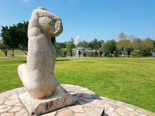
Park nearby Садик Бэйби Консерваторион גן ביבי קונסרבטוריון מ 2016
Садик Бэйби Консерваторион גן ביבי קונסרבטוריון מ 2016
10, Shim'oni Street, Ramat Gan, IL Израиль
contacts phone
:
+972 54-630-7689
website:
m.facebook.com
Latitude:
32.0514961
, Longitude:
34.818814
larger map & directions
read more
nearest Park
141 m
Efrayim Ed Goldberg Garden
Рамат-Ган
Park
read more
141 m
גן אפרים אד גולדנברג
רמת גן
Park
read more
271 m
גן חווה
רמת גן
Park
read more
317 m
HaBanim Garden
Рамат-Ган
Park
read more
368 m
גינת כלבים הפארק הלאומי
רמת גן
Park
read more
405 m
Ha-Rav Pardes Square
Рамат-Ган
Park
read more
441 m
פארק כלבים - Dog park
רמת גן
Park
read more
497 m
Casuarinas Garden
Рамат-Ган
Park
read more
510 m
גן שעשועים לילדים- הפארק הלאומי
רמת גן
Park
read more
591 m
Uzi Khitman Square
Рамат-Ган
Park
read more
626 m
Стоянка внутри парка леуми
רמת גן
Park
read more
626 m
National park Ramat Gan
Ahad Ha'Am Street 3, Ramat Gan
Park
read more
626 m
הפארק הלאומי רמת גן
אחד העם 3, רמת גן
Park
read more
626 m
Нешнел парк Рамат-Ган
Ahad Ha'Am Street 3, Ramat Gan
Park
read more
708 m
גינת שעשועים
יאיר 34, רמת גן
Park
read more
817 m
גן הקקטוסים
Ramat Gan
Park
read more
828 m
Harzfeld Garden
Tel Aviv-Yafo
Park
read more
848 m
גינה ציבורית
עזרא קורין 2-12, תל אביב יפו
Park
read more
945 m
Murray Goldman Park
Тель-Авив
Park
read more
945 m
Murray Goldman Park
Tel Aviv-Yafo
Park
read more
945 m
פארק מורי גולדמן
תל אביב יפו
Park
read more
985 m
Tabenkin Garden
Рамат-Ган
Park
read more
1.053 km
גן ילדי הגנים
גבעתיים
Park
read more
1.053 km
Yaldi HaGanim Garden
Гиватаим
Park
read more
1.053 km
Yaldi HaGanim Garden
Giv'Atayim
Park
read more
📑
all categories
Accounting
Administrative area level 1
Administrative area level 2
Airport
Amusement park
Aquarium
Art gallery
Atm
Bakery
Bank
Bar
Beauty salon
Bicycle store
Book store
Bowling alley
Bus station
Cafe
Campground
Car dealer
Car rental
Car repair
Car wash
Casino
Cemetery
Church
City hall
Clothing store
Colloquial area
Convenience store
Country
Courthouse
Dentist
Department store
Doctor
Electrician
Electronics store
Embassy
Establishment
Finance
Fire station
Florist
Food
Funeral home
Furniture store
Gas station
General contractor
Grocery or supermarket
Gym
Hair care
Hardware store
Health
Hindu Temple
Home goods store
Hospital
Insurance agency
Intersection
Jewelry store
Laundry
Lawyer
Library
Light rail station
Liquor store
Local government office
Locality
Locksmith
Lodging
Meal delivery
Meal takeaway
Mosque
Movie rental
Movie theater
Moving company
Museum
Natural feature
Neighborhood
Night club
Painter
Park
Parking
Pet store
Pharmacy
Physiotherapist
Place of worship
Plumber
Point of interest
Police
Political
Post office
Premise
Real estate agency
Restaurant
Roofing contractor
Route
Rv park, camping
School
Shoe store
Shopping mall
Spa
Stadium
Storage
Store
Subpremise
Subway station
Supermarket
Synagogue
Taxi stand
Train station
Transit station
Travel agency
University
Veterinary care
Zoo
administrative area level 3
administrative area level 4
sublocality level 1
↑