Park nearby Municipality Samu Park
Coronavirus disease (COVID-19) Situation
confirmed cases
4841772
deaths
12707
Israel
Park nearby Municipality Samu Park
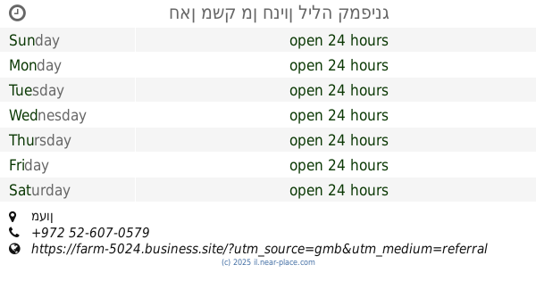
Municipality Samu Park
סמוע
contacts phone
:
+972
Latitude:
31.4040111
, Longitude:
35.0713484
larger map & directions
read more
nearest Park
5.765 km
גן אברהם
עותניאל
Park
read more
5.769 km
גן אברהם
שמעה
Park
read more
7.148 km
Yatir Forest
Israel
Park
read more
7.148 km
Bosque de Yatir
Israel
Park
read more
7.148 km
יער יתיר
Israel
Park
read more
7.554 km
Onyx Industrial Zone
Israel National Trail
Park
read more
7.554 km
אזור תעשיה שוהם
שביל ישראל
Park
read more
9.952 km
גן אביחי
חגי
Park
read more
10.181 km
חאן משק מן חניון לילה קמפינג
מעון
Campground
Lodging
Park
Food
Point of interest
Establishment
read more
11.43 km
الحديقة التكنولوجية Bgz
Fire Tower Road, Hebron
Park
read more
13.403 km
حديقة الزهراء العامة
חברון, אריאל
Park
read more
13.627 km
منتزه لوزا بارك
G2GX+3Q2, Luza
Campground
Lodging
Park
Point of interest
Establishment
read more
14.228 km
Peace Park
مربعة, Ceuta
Park
read more
14.559 km
HaZeitim Park
Meitar
Park
read more
14.559 km
פארק הזיתים
מיתר
Park
read more
14.961 km
פארק מרכזי
מיתר
Park
read more
14.961 km
Central Park
Meitar
Park
read more
15.082 km
Vardimon Garden
Meitar
Park
read more
15.155 km
Park
Ain Sarah, Hebron
Park
read more
15.269 km
Garden Vardimon
Meitar
Park
read more
15.598 km
Rabin Park
Мейтар
Park
read more
15.773 km
מנהרה פארק רבין מיתר
Ge'on ha-Yarden Street 30-34, Meitar
Park
read more
15.773 km
מנהרה פארק רבין מיתר
גאון הירדן 30-34, מיתר
Park
read more
19.965 km
מעוף
נקר
Park
read more
20.5 km
גן הבנים
אמציה
Park
read more
📑
all categories
Accounting
Administrative area level 1
Administrative area level 2
Airport
Amusement park
Aquarium
Art gallery
Atm
Bakery
Bank
Bar
Beauty salon
Bicycle store
Book store
Bowling alley
Bus station
Cafe
Campground
Car dealer
Car rental
Car repair
Car wash
Casino
Cemetery
Church
City hall
Clothing store
Colloquial area
Convenience store
Country
Courthouse
Dentist
Department store
Doctor
Electrician
Electronics store
Embassy
Establishment
Finance
Fire station
Florist
Food
Funeral home
Furniture store
Gas station
General contractor
Grocery or supermarket
Gym
Hair care
Hardware store
Health
Hindu Temple
Home goods store
Hospital
Insurance agency
Intersection
Jewelry store
Laundry
Lawyer
Library
Light rail station
Liquor store
Local government office
Locality
Locksmith
Lodging
Meal delivery
Meal takeaway
Mosque
Movie rental
Movie theater
Moving company
Museum
Natural feature
Neighborhood
Night club
Painter
Park
Parking
Pet store
Pharmacy
Physiotherapist
Place of worship
Plumber
Point of interest
Police
Political
Post office
Premise
Real estate agency
Restaurant
Roofing contractor
Route
Rv park, camping
School
Shoe store
Shopping mall
Spa
Stadium
Storage
Store
Subpremise
Subway station
Supermarket
Synagogue
Taxi stand
Train station
Transit station
Travel agency
University
Veterinary care
Zoo
administrative area level 3
administrative area level 4
sublocality level 1
↑