Night club nearby מועדון הישוב גן נר
Coronavirus disease (COVID-19) Situation
confirmed cases
4841772
deaths
12707
Israel
Night club nearby מועדון הישוב גן נר
מועדון הישוב גן נר
גן נר, ישראל
contacts phone
:
+972
Latitude:
32.527282
, Longitude:
35.3349715
larger map & directions
read more
nearest Night club
מועדון הישוב גן נר
Gan Ner
Night club
read more
12.863 km
Galleries Nour Wedding
7 7، Мокрен
Night club
read more
17.58 km
בארקה
תחנת דלק דור אלון, כביש 90
Night club
read more
19.993 km
הבית של אסא
כפר החורש
Night club
read more
19.993 km
הבית של אסא
Kfar HaHoresh
Night club
read more
21.619 km
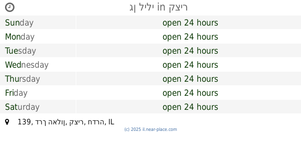
גן לילי
Ha Alon Road 139, Qazir
Night club
read more
21.619 km
גן לילי
דרך האלון 139, קציר
Night club
read more
22.548 km
Royality
Ar'ara
Night club
read more
22.548 km
גני רויאליטי
ערערה
Night club
read more
24.521 km
גינה קהילתית - פאב
גלעד
Night club
read more
24.521 km
גינה קהילתית - פאב
Gal'ed
Night club
read more
24.978 km
הדיסקוטק רמת ישי
Horesh HaAlonim Street, Ramat Yishai
Night club
read more
25.056 km
Plugin
סטריט מול, האקליפטוס 3, רמת ישי
Night club
read more
25.486 km
Bikini Lotem
Israel
Night club
read more
28.198 km
SUNSARA Summer Club
Unnamed Road, Afikim
Night club
read more
28.212 km
דוריס בר
אפיקים
Night club
read more
40.209 km
Geek House
Haifa
Night club
read more
40.492 km
מועדון המלינה
שדרות ההסתדרות 60, חיפה
Night club
read more
42.108 km
טייפון
חיפה
Night club
read more
43.303 km
גיי טבעי
Sderot Robert Sold 40, Kiryat Yam
Night club
read more
44.82 km
Rup's
4
Night club
read more
46.681 km
beso club
קניון אם הדרך, Beit Herut
Night club
read more
49.511 km
Peilim Empire
תל מונד
Night club
read more
59.601 km
zaza24
Ha-Avoda Street 24, Rosh Haayin
Night club
read more
66.161 km
Jeassica Jessi Club
HaShiloah Street 4, Petah Tikva
Night club
read more
📑
all categories
Accounting
Administrative area level 1
Administrative area level 2
Airport
Amusement park
Aquarium
Art gallery
Atm
Bakery
Bank
Bar
Beauty salon
Bicycle store
Book store
Bowling alley
Bus station
Cafe
Campground
Car dealer
Car rental
Car repair
Car wash
Casino
Cemetery
Church
City hall
Clothing store
Colloquial area
Convenience store
Country
Courthouse
Dentist
Department store
Doctor
Electrician
Electronics store
Embassy
Establishment
Finance
Fire station
Florist
Food
Funeral home
Furniture store
Gas station
General contractor
Grocery or supermarket
Gym
Hair care
Hardware store
Health
Hindu Temple
Home goods store
Hospital
Insurance agency
Intersection
Jewelry store
Laundry
Lawyer
Library
Light rail station
Liquor store
Local government office
Locality
Locksmith
Lodging
Meal delivery
Meal takeaway
Mosque
Movie rental
Movie theater
Moving company
Museum
Natural feature
Neighborhood
Night club
Painter
Park
Parking
Pet store
Pharmacy
Physiotherapist
Place of worship
Plumber
Point of interest
Police
Political
Post office
Premise
Real estate agency
Restaurant
Roofing contractor
Route
Rv park, camping
School
Shoe store
Shopping mall
Spa
Stadium
Storage
Store
Subpremise
Subway station
Supermarket
Synagogue
Taxi stand
Train station
Transit station
Travel agency
University
Veterinary care
Zoo
administrative area level 3
administrative area level 4
sublocality level 1
↑