Library nearby ספריית כברי
Israel
Library nearby ספריית כברי
ספריית כברי
Kabri Israel
contacts phone
:
+972
Latitude:
33.0210283
, Longitude:
35.1474674
read more
nearest Library
ספריית כברי
כברי
Library
read more
4.202 km
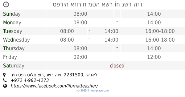
ספריה אזורית מטה אשר
בית ספר סולם צור, גשר הזיו
Library
read more
4.308 km
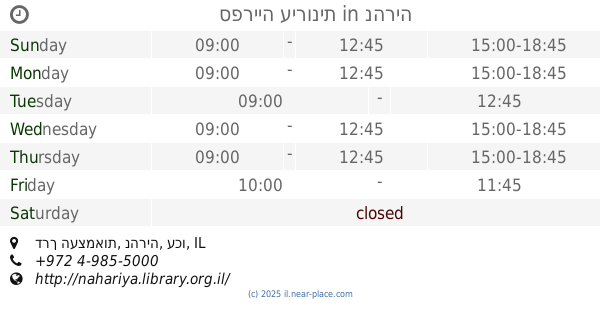
ספרייה עירונית
דרך העצמאות פינת הר תבור, נהריה
Library
read more
4.308 km
ספרייה עירונית
דרך העצמאות, נהריה
Library
read more
4.308 km
Municipality Library
Derech HaAtsma'ut, Nahariyya
Library
read more
4.308 km
Municipality Library
דרך העצמאות פינת הר תבור, Nahariyya
Library
read more
9.443 km
ספרית אלעין
Unnamed Road,, Yarka
Library
read more
9.443 km
Al-Ayn Library
Unnamed Road,, Yarka
Library
read more
12.628 km
Library of Canada
ויצמן 13, עכו
Library
read more
15.299 km
Scout Center
פסוטה
Library
read more
15.299 km
Scout Center
Fassuta
Library
read more
17.359 km
ספריית אורט בראודה
כרמיאל
Library
read more
17.359 km
ספריית אורט בראודה
Karmiel
Library
read more
18.762 km
Библиотека Кармиэль
Tsahal Street 107, Karmiel
Library
read more
18.762 km
Karmiel Library
צה"ל 107, כרמיאל
Library
read more
20.927 km
Misgav Regional Council Library
Misgav
Library
read more
21.024 km
ספרייה עירונית
דקר 5, קרית מוצקין
Library
read more
21.024 km
Municipal Library
Dakar Street 5, Kiryat Motzkin
Library
read more
22.182 km
ספריה עירונית ע״ש יעקב שטרן
Mohiliver Street 8-12, Haifa
Library
read more
22.275 km
Municipal Library
Efrayim Street 30, Kiryat Bialik
Library
read more
23.357 km
Beit Chabad Library
Einstein Street 10, Kiryat Ata
Library
read more
23.357 km
ספריית בית חבד
איינשטיין 10, קרית אתא
Library
read more
24.097 km
Municipality Library
רמז 14, Kiryat Ata
Library
read more
25.413 km
Library Almoatz
Kafr Manda
Library
read more
27.089 km
Clore Children's Cultural Centre and Library
Haifa
Library
read more
📑
all categories
Accounting
Administrative area level 1
Administrative area level 2
Airport
Amusement park
Aquarium
Art gallery
Atm
Bakery
Bank
Bar
Beauty salon
Bicycle store
Book store
Bowling alley
Bus station
Cafe
Campground
Car dealer
Car rental
Car repair
Car wash
Casino
Cemetery
Church
City hall
Clothing store
Colloquial area
Convenience store
Country
Courthouse
Dentist
Department store
Doctor
Electrician
Electronics store
Embassy
Establishment
Finance
Fire station
Florist
Food
Funeral home
Furniture store
Gas station
General contractor
Grocery or supermarket
Gym
Hair care
Hardware store
Health
Hindu Temple
Home goods store
Hospital
Insurance agency
Intersection
Jewelry store
Laundry
Lawyer
Library
Light rail station
Liquor store
Local government office
Locality
Locksmith
Lodging
Meal delivery
Meal takeaway
Mosque
Movie rental
Movie theater
Moving company
Museum
Natural feature
Neighborhood
Night club
Painter
Park
Parking
Pet store
Pharmacy
Physiotherapist
Place of worship
Plumber
Point of interest
Police
Political
Post office
Premise
Real estate agency
Restaurant
Roofing contractor
Route
Rv park, camping
School
Shoe store
Shopping mall
Spa
Stadium
Storage
Store
Subpremise
Subway station
Supermarket
Synagogue
Taxi stand
Train station
Transit station
Travel agency
University
Veterinary care
Zoo
administrative area level 3
administrative area level 4
sublocality level 1
↑