Gym nearby Yazan Taekwondo Center
Coronavirus disease (COVID-19) Situation
confirmed cases
4841772
deaths
12707
Israel
Gym nearby Yazan Taekwondo Center
Yazan Taekwondo Center
Rue Attil, Rabat
contacts phone
:
+970 598 985 111
Latitude:
32.3680728
, Longitude:
35.0705041
larger map & directions
read more
nearest Gym
3.697 km
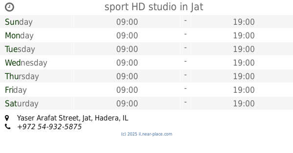
sport HD studio
Yaser Arafat Street, Jat
Gym
read more
3.697 km
sport HD studio
יאסר ערפאת, ג'ת
Gym
read more
3.835 km
Esawy Gym
Jat
Gym
read more
4.778 km
ברית רנאן
Be'er Alsama'a Street, Jat
Gym
read more
6.659 km
ergo4u Ltd
Gil'ad Street 23, Bat Hefer
Gym
read more
8.155 km
סטודיו המעפיל
HaMa'apil
Gym
read more
10.334 km
Ornetpower
mahsom shaar Ephraim
Gym
read more
12.311 km
מיי ג'ים
Nakhal Poleg Street, Hadera
Gym
read more
13.309 km
גן כושר
Givat Haim
Gym
read more
13.661 km
נירוונה
נירוונה, Ein Iron
Gym
read more
14.472 km
יוגימא - יוגה וסדנאות מבטן ומלידה
Bazelet Street 20, Kfar Yona
Gym
read more
14.472 km
יוגימא - יוגה וסדנאות מבטן ומלידה
בזלת 20, כפר יונה
Gym
read more
14.794 km
ספורט לייף
האורנים 2 פרדס חנה
Gym
read more
14.959 km
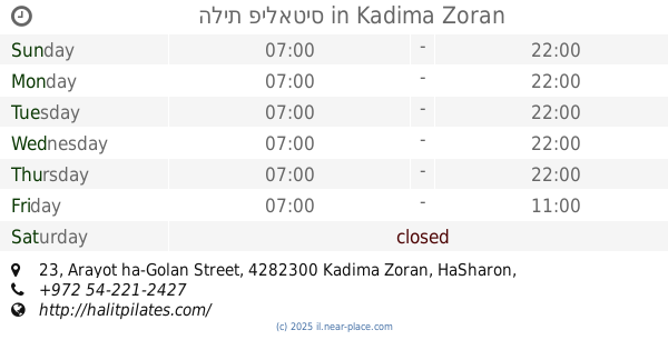
הלית פילאטיס
Arayot ha-Golan Street 23, Kadima Zoran
Gym
read more
15.363 km
מרכז פייס צפרירים חדרה - קרב מגע קפוארה ג'ודו ג'יו ג'יטסו אייקידו עמי ניב
האלון 10, חדרה, ישראל, Hadera
Gym
read more
15.729 km
Samuel Lederman
Nahal Kane Street 6, Tzur Yitzhak
Gym
read more
15.972 km
מֶרחָב
שדרות רוטשילד 40, חדרה
Gym
read more
15.986 km
אלכס ניימרק
Etsel Street 11, Hadera
Gym
read more
16.617 km
Or Aaron personal training
Rambam Street 20, Hadera
Gym
read more
16.837 km
Krav Maga Aiki Ami Niv - קרב מגע אייקי עמי ניב
לבזובסקי 2, חדרה
Gym
read more
17.18 km
קרוספיט חדרה
HaMasger Street 22, Hadera
Gym
read more
17.412 km
Studio Koshka
Ha-Nagar Street, Kadima Zoran
Gym
read more
18.275 km
بركه الطيرة
א נדא, טירה
Gym
read more
18.481 km
Beauty Gym
Unnamed Road, טירה
Gym
read more
19.1 km
Samurai Fitness Club
Ha-Dekel Street 55, Tel Mond
Gym
read more
📑
all categories
Accounting
Administrative area level 1
Administrative area level 2
Airport
Amusement park
Aquarium
Art gallery
Atm
Bakery
Bank
Bar
Beauty salon
Bicycle store
Book store
Bowling alley
Bus station
Cafe
Campground
Car dealer
Car rental
Car repair
Car wash
Casino
Cemetery
Church
City hall
Clothing store
Colloquial area
Convenience store
Country
Courthouse
Dentist
Department store
Doctor
Electrician
Electronics store
Embassy
Establishment
Finance
Fire station
Florist
Food
Funeral home
Furniture store
Gas station
General contractor
Grocery or supermarket
Gym
Hair care
Hardware store
Health
Hindu Temple
Home goods store
Hospital
Insurance agency
Intersection
Jewelry store
Laundry
Lawyer
Library
Light rail station
Liquor store
Local government office
Locality
Locksmith
Lodging
Meal delivery
Meal takeaway
Mosque
Movie rental
Movie theater
Moving company
Museum
Natural feature
Neighborhood
Night club
Painter
Park
Parking
Pet store
Pharmacy
Physiotherapist
Place of worship
Plumber
Point of interest
Police
Political
Post office
Premise
Real estate agency
Restaurant
Roofing contractor
Route
Rv park, camping
School
Shoe store
Shopping mall
Spa
Stadium
Storage
Store
Subpremise
Subway station
Supermarket
Synagogue
Taxi stand
Train station
Transit station
Travel agency
University
Veterinary care
Zoo
administrative area level 3
administrative area level 4
sublocality level 1
↑