Gas station nearby עקרון Ten
Israel
Gas station nearby עקרון Ten
עקרון Ten
14, בוסי סנט ג'ורג', קרית עקרון, רחובות, IL ישראל
contacts phone
:
+972 8-935-0984
website:
www.10ten.co.il
Latitude:
31.86277
, Longitude:
34.8147
larger map & directions
read more
nearest Gas station
עקרון Ten
Bussy Saint Georges Street 14, Kiryat Ekron
Gas station
read more
378 m
פז נויה
כביש 40, גבעת ברנר
Gas station
read more
412 m
דור אלון
קרית עקרון
Gas station
read more
483 m
פז קריית עקרון
המלך חסן השני, קרית עקרון
Gas station
read more
483 m
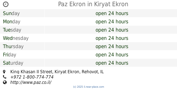
Paz Ekron
King Khasan II Street, Kiryat Ekron
Gas station
read more
504 m
קרית עקרון דלק
קרית עקרון
Gas station
read more
504 m
קרית עקרון דלק
Kiryat Ekron
Gas station
read more
504 m
Delek
Kiryat Ekron
Gas station
read more
504 m
דלק קרית עקרון
שדרות יצחק רבין, קרית עקרון
Gas station
read more
733 m
סדש
גבעת ברנר
Gas station
read more
1.237 km
סונול מיקה רחובות
בילו סנטר, רחובות
Gas station
read more
1.237 km
Сонол
בילו סנטר, רחובות
Gas station
read more
2.49 km
Sha'arayim
Rehovot
Gas station
read more
2.494 km
פז רמה רחובות
הרצל 41, רחובות
Gas station
read more
2.494 km
תחנת רמה רחובות
Herzl Street 41, Rehovot
Gas station
read more
2.966 km
דלק מזכרת בתיה
שדרות מוטה גור 1, מזכרת בתיה
Gas station
read more
2.966 km
תחנת דלק מזכרת בתיה
Sderot Mota Gur 1, Mazkeret Batya
Gas station
read more
2.966 km
Delek
Sderot Mota Gur 1, Mazkeret Batya
Gas station
read more
2.966 km
דלק מזכרת בתיה
Sderot Mota Gur 1, Mazkeret Batya
Gas station
read more
2.966 km
דלק
שדרות מוטה גור 1, מזכרת בתיה
Gas station
read more
3.997 km
Delek
HaYam Road 12, Rehovot
Gas station
read more
4.134 km
פז רכטמן רחובות
א"ת רכטמן, קלמן גבריאלוב פינת היצירה, Rehovot
Gas station
read more
4.134 km
פז רכטמן רחובות
א"ת רכטמן, קלמן גבריאלוב, רחובות
Gas station
read more
4.134 km
פז רכטמן רחובות
א"ת רכטמן, קלמן גבריאלוב פינת היצירה, רחובות
Gas station
read more
4.623 km
פז יד ויצמן
הרצל 223, רחובות
Gas station
read more
📑
all categories
Accounting
Administrative area level 1
Administrative area level 2
Airport
Amusement park
Aquarium
Art gallery
Atm
Bakery
Bank
Bar
Beauty salon
Bicycle store
Book store
Bowling alley
Bus station
Cafe
Campground
Car dealer
Car rental
Car repair
Car wash
Casino
Cemetery
Church
City hall
Clothing store
Colloquial area
Convenience store
Country
Courthouse
Dentist
Department store
Doctor
Electrician
Electronics store
Embassy
Establishment
Finance
Fire station
Florist
Food
Funeral home
Furniture store
Gas station
General contractor
Grocery or supermarket
Gym
Hair care
Hardware store
Health
Hindu Temple
Home goods store
Hospital
Insurance agency
Intersection
Jewelry store
Laundry
Lawyer
Library
Light rail station
Liquor store
Local government office
Locality
Locksmith
Lodging
Meal delivery
Meal takeaway
Mosque
Movie rental
Movie theater
Moving company
Museum
Natural feature
Neighborhood
Night club
Painter
Park
Parking
Pet store
Pharmacy
Physiotherapist
Place of worship
Plumber
Point of interest
Police
Political
Post office
Premise
Real estate agency
Restaurant
Roofing contractor
Route
Rv park, camping
School
Shoe store
Shopping mall
Spa
Stadium
Storage
Store
Subpremise
Subway station
Supermarket
Synagogue
Taxi stand
Train station
Transit station
Travel agency
University
Veterinary care
Zoo
administrative area level 3
administrative area level 4
sublocality level 1
↑