Gas station nearby דור אלון נען מערב
Coronavirus disease (COVID-19) Situation
confirmed cases
4841772
deaths
12707
Israel
Gas station nearby דור אלון נען מערב
דור אלון נען מערב
גזר, ישראל
contacts phone
:
+972 54-543-8320
website:
www.doralon.co.il
Latitude:
31.8821878
, Longitude:
34.8785757
larger map & directions
read more
nearest Gas station
102 m
Dor Alon Naan East, Highway 6
Na'an
Gas station
read more
102 m
דור אלון נען מזרח
נען
Gas station
read more
2.601 km
Dor Alon
כביש 44, פתחיה
Gas station
read more
2.601 km
דור אלון
כביש 44, פתחיה
Gas station
read more
3.975 km
Заправка 10 TEN
Ramla
Gas station
read more
4.102 km
תחנת דלק דלק נשר
רמלה
Gas station
read more
4.204 km
תחנת דלק
יוסף קלוזנר 10, רמלה
Gas station
read more
4.204 km
Gas Station
Klausner Yosef Street 10, Ramla
Gas station
read more
4.306 km
Taavura
Ramla
Gas station
read more
4.446 km
דלק
קלאוזנר 16, רמלה
Gas station
read more
4.446 km
Delek Klausner
קלאוזנר 16, רמלה
Gas station
read more
4.446 km
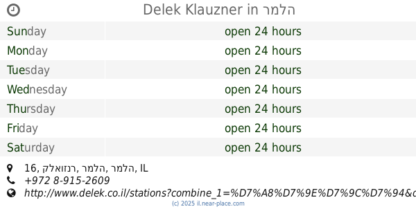
Delek Klauzner
קלאוזנר 16, רמלה
Gas station
read more
4.446 km
דלק קלאוזנר
קלאוזנר 16, רמלה
Gas station
read more
4.472 km
פז רמלה גדולה
שדרות הרצל 117, רמלה
Gas station
read more
4.597 km
סונול רמלה העיר
Yousef Klausner St. פינת Sderot Herzl, רמלה
Gas station
read more
4.597 km
סונול רמלה העיר
Yousef Klausner St. פינת Sderot Herzl, Ramla
Gas station
read more
4.597 km
סונול רמלה העיר
Yousef Klausner St., רמלה
Gas station
read more
4.699 km
רמלה (גדולה)
רמלה
Gas station
read more
4.699 km
Ramla (Gdola)
Ramla
Gas station
read more
4.721 km
פז רמלה קטנה
Sderot Herzl 89, Ramla
Gas station
read more
5.39 km
דלק
שדרות מוטה גור 1, מזכרת בתיה
Gas station
read more
5.39 km
דלק מזכרת בתיה
Sderot Mota Gur 1, Mazkeret Batya
Gas station
read more
5.39 km
Delek
Sderot Mota Gur 1, Mazkeret Batya
Gas station
read more
5.39 km
תחנת דלק מזכרת בתיה
Sderot Mota Gur 1, Mazkeret Batya
Gas station
read more
5.567 km
Paz Mazkeret Batya
כביש 411, מזכרת בתיה
Gas station
read more
📑
all categories
Accounting
Administrative area level 1
Administrative area level 2
Airport
Amusement park
Aquarium
Art gallery
Atm
Bakery
Bank
Bar
Beauty salon
Bicycle store
Book store
Bowling alley
Bus station
Cafe
Campground
Car dealer
Car rental
Car repair
Car wash
Casino
Cemetery
Church
City hall
Clothing store
Colloquial area
Convenience store
Country
Courthouse
Dentist
Department store
Doctor
Electrician
Electronics store
Embassy
Establishment
Finance
Fire station
Florist
Food
Funeral home
Furniture store
Gas station
General contractor
Grocery or supermarket
Gym
Hair care
Hardware store
Health
Hindu Temple
Home goods store
Hospital
Insurance agency
Intersection
Jewelry store
Laundry
Lawyer
Library
Light rail station
Liquor store
Local government office
Locality
Locksmith
Lodging
Meal delivery
Meal takeaway
Mosque
Movie rental
Movie theater
Moving company
Museum
Natural feature
Neighborhood
Night club
Painter
Park
Parking
Pet store
Pharmacy
Physiotherapist
Place of worship
Plumber
Point of interest
Police
Political
Post office
Premise
Real estate agency
Restaurant
Roofing contractor
Route
Rv park, camping
School
Shoe store
Shopping mall
Spa
Stadium
Storage
Store
Subpremise
Subway station
Supermarket
Synagogue
Taxi stand
Train station
Transit station
Travel agency
University
Veterinary care
Zoo
administrative area level 3
administrative area level 4
sublocality level 1
↑