Church nearby Church of St. Lazarus
Coronavirus disease (COVID-19) Situation
confirmed cases
4841772
deaths
12707
Israel
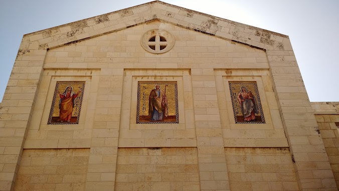
Church nearby Church of St. Lazarus
Church of St. Lazarus
אל חיג'אר, al-Eizariya
contacts phone
:
+972
Latitude:
31.7715832
, Longitude:
35.2562173
larger map & directions
read more
nearest Church
Church of St. Lazarus
El Hij'ar Street, al-Eizariya
Church
read more
1.155 km
כנסייה רוסית טור מלכא
ירושלים
Church
read more
1.271 km
Pater Noster church
הר הזיתים, Jerusalem
Church
read more
1.271 km
Церковь Отче наш
הר הזיתים, Jerusalem
Church
read more
1.271 km
כנסיית פאטר נוסטר
הר הזיתים, ירושלים
Church
read more
1.331 km
כנסיית העלייה
ירושלים
Church
read more
1.331 km
Chapel of the Ascension
Jerusalem
Church
read more
1.338 km
מנזר הכרמליטים
ירושלים
Church
read more
1.338 km
Monastery Carmel Pater Noster
Jerusalem
Church
read more
1.529 km
כנסיית דומינוס פלוויט
ירושלים
Church
read more
1.646 km
Church of Viri Galilaei
Jerusalem
Church
read more
1.658 km
כנסיית מריה מגדלנה
ירושלים
Church
read more
1.762 km
Himmelfahrtskirche Auguste Viktoria
Martin Buber Straße, Jerusalem
Church
read more
1.765 km
Ascension Church
Martin Buber Street, Jerusalem
Church
read more
1.765 km
כנסיית העלייה
מרטין בובר, ירושלים
Church
read more
2.131 km
Church of Saint Anne and the Pools of Bethesda
Jerusalem
Church
read more
2.131 km
Church of Saint Anne and the Pools of Bethesda
ירושלים
Church
read more
2.166 km
Iglesia de Santa Ana
Jerusalem
Church
read more
2.166 km
St. Anne's Church
ירושלים
Church
read more
2.166 km
Базилика Святой Анны
Jerusalem
Church
read more
2.474 km
Via Dolorosa
ירושלים
Church
read more
2.873 km
סנט סלוואדור
ירושלים
Church
read more
2.895 km
סנט אטיין
Nablus Road 83, ירושלים
Church
read more
2.944 km
Andreaskirche
David Remez Street 1, Jerusalem
Church
read more
3.043 km
Deir Salzayani
Jerusalem
Church
read more
📑
all categories
Accounting
Administrative area level 1
Administrative area level 2
Airport
Amusement park
Aquarium
Art gallery
Atm
Bakery
Bank
Bar
Beauty salon
Bicycle store
Book store
Bowling alley
Bus station
Cafe
Campground
Car dealer
Car rental
Car repair
Car wash
Casino
Cemetery
Church
City hall
Clothing store
Colloquial area
Convenience store
Country
Courthouse
Dentist
Department store
Doctor
Electrician
Electronics store
Embassy
Establishment
Finance
Fire station
Florist
Food
Funeral home
Furniture store
Gas station
General contractor
Grocery or supermarket
Gym
Hair care
Hardware store
Health
Hindu Temple
Home goods store
Hospital
Insurance agency
Intersection
Jewelry store
Laundry
Lawyer
Library
Light rail station
Liquor store
Local government office
Locality
Locksmith
Lodging
Meal delivery
Meal takeaway
Mosque
Movie rental
Movie theater
Moving company
Museum
Natural feature
Neighborhood
Night club
Painter
Park
Parking
Pet store
Pharmacy
Physiotherapist
Place of worship
Plumber
Point of interest
Police
Political
Post office
Premise
Real estate agency
Restaurant
Roofing contractor
Route
Rv park, camping
School
Shoe store
Shopping mall
Spa
Stadium
Storage
Store
Subpremise
Subway station
Supermarket
Synagogue
Taxi stand
Train station
Transit station
Travel agency
University
Veterinary care
Zoo
administrative area level 3
administrative area level 4
sublocality level 1
↑