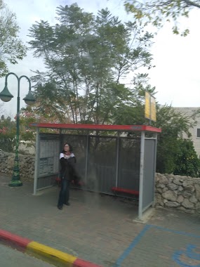
Bus station nearby HaDror/Dukhifat Lane
Coronavirus disease (COVID-19) Situation
confirmed cases
4841772
deaths
12707
Israel
Bus station nearby HaDror/Dukhifat Lane
HaDror/Dukhifat Lane
Israel Израиль
contacts phone
:
+972
Latitude:
31.807363
, Longitude:
35.145324
read more
nearest Bus station
הדרור/סמטת דוכיפת
Israel
Bus station
read more
37 m
HaDror/HaSnunit
Israel
Bus station
read more
296 m
HaDror/HaZamir
Israel
Bus station
read more
320 m
HaDror/Hermon
Israel
Bus station
read more
410 m
Karmel/HaDror
Israel
Bus station
read more
549 m
Hermon/Mt. Meiron
Israel
Bus station
read more
560 m
יסמין
Israel
Bus station
read more
560 m
Yasmin
Israel
Bus station
read more
660 m
הראל/יצחק נסים
Israel
Bus station
read more
663 m
Karmel/Hermon
Israel
Bus station
read more
671 m
Police Station/Har'el
Israel
Bus station
read more
696 m
Sport Center
Israel
Bus station
read more
714 m
יסמין/שבי ציון
Israel
Bus station
read more
739 m
יסמין/מבוא טללים
Israel
Bus station
read more
750 m
מרכז קליטה/הראל
Israel
Bus station
read more
750 m
Absorption Center/Har'el
Israel
Bus station
read more
808 m
Oren/Brosh
Israel
Bus station
read more
816 m
Yasmin/Keren HaYesod
Israel
Bus station
read more
829 m
כרמל/ארבל
Israel
Bus station
read more
862 m
הראל/יסמין
Israel
Bus station
read more
897 m
מחלף הראל
Israel
Bus station
read more
960 m
HaHoshen Blvd/Har'el
Israel
Bus station
read more
1.014 km
HaShalom/Kalanit
Israel
Bus station
read more
1.055 km
ברוש/חבצלת
Israel
Bus station
read more
1.099 km
Oren/Havatselet
Israel
Bus station
read more
📑
all categories
Accounting
Administrative area level 1
Administrative area level 2
Airport
Amusement park
Aquarium
Art gallery
Atm
Bakery
Bank
Bar
Beauty salon
Bicycle store
Book store
Bowling alley
Bus station
Cafe
Campground
Car dealer
Car rental
Car repair
Car wash
Casino
Cemetery
Church
City hall
Clothing store
Colloquial area
Convenience store
Country
Courthouse
Dentist
Department store
Doctor
Electrician
Electronics store
Embassy
Establishment
Finance
Fire station
Florist
Food
Funeral home
Furniture store
Gas station
General contractor
Grocery or supermarket
Gym
Hair care
Hardware store
Health
Hindu Temple
Home goods store
Hospital
Insurance agency
Intersection
Jewelry store
Laundry
Lawyer
Library
Light rail station
Liquor store
Local government office
Locality
Locksmith
Lodging
Meal delivery
Meal takeaway
Mosque
Movie rental
Movie theater
Moving company
Museum
Natural feature
Neighborhood
Night club
Painter
Park
Parking
Pet store
Pharmacy
Physiotherapist
Place of worship
Plumber
Point of interest
Police
Political
Post office
Premise
Real estate agency
Restaurant
Roofing contractor
Route
Rv park, camping
School
Shoe store
Shopping mall
Spa
Stadium
Storage
Store
Subpremise
Subway station
Supermarket
Synagogue
Taxi stand
Train station
Transit station
Travel agency
University
Veterinary care
Zoo
administrative area level 3
administrative area level 4
sublocality level 1
↑