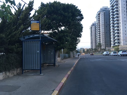
Bus station nearby דרך הים/ההרדוף
Israel
Bus station nearby דרך הים/ההרדוף
דרך הים/ההרדוף
חיפה, ישראל
contacts phone
:
+972
Latitude:
32.811006
, Longitude:
34.970419
larger map & directions
read more
nearest Bus station
495 m
Levona/Mor
Israel
Bus station
read more
497 m
Mt. Carmel Hotel/Ilanot
Israel
Bus station
read more
505 m
Kabirim/Levona
Israel
Bus station
read more
552 m
Ovadia/Bet El
Israel
Bus station
read more
561 m
רבווה/רענן
Israel
Bus station
read more
574 m
Levona/Mor B
Israel
Bus station
read more
629 m
Kabirim/Jalal a-Din
Israel
Bus station
read more
663 m
HaYam Road/HaRakafot
Israel
Bus station
read more
701 m
אסתר המלכה
Israel
Bus station
read more
706 m
Ra'anan/Jalal a-Din
Israel
Bus station
read more
811 m
HaMelekh Shlomo/HaMelekh Amatsyahu
Israel
Bus station
read more
812 m
Bet El/HaTishbi
Israel
Bus station
read more
833 m
המלך שלמה/המלך חזקיהו
Israel
Bus station
read more
833 m
HaMelekh Shlomo/HaMelekh Hizkiyahu
Israel
Bus station
read more
835 m
Cemetery/Oren Gate
Israel
Bus station
read more
931 m
HaMelekh Shlomo/Etzel
Israel
Bus station
read more
945 m
Bethlehem A
Israel
Bus station
read more
970 m
Ra'anan/Amikam
Israel
Bus station
read more
1.016 km
בית ספר אופקים/דרך הים
Israel
Bus station
read more
1.023 km
המלך שאול/המלך דוד
Israel
Bus station
read more
1.023 km
HaMelekh Sha'ul/HaMelekh David
Israel
Bus station
read more
1.089 km
HaYam Road/Eshkholot
Israel
Bus station
read more
1.114 km
Bar Rav Hai/Marseille
Israel
Bus station
read more
1.325 km
Pinski/HaVradim
Israel
Bus station
read more
1.337 km
הבישוף חגאר/עבאס
Israel
Bus station
read more
📑
all categories
Accounting
Administrative area level 1
Administrative area level 2
Airport
Amusement park
Aquarium
Art gallery
Atm
Bakery
Bank
Bar
Beauty salon
Bicycle store
Book store
Bowling alley
Bus station
Cafe
Campground
Car dealer
Car rental
Car repair
Car wash
Casino
Cemetery
Church
City hall
Clothing store
Colloquial area
Convenience store
Country
Courthouse
Dentist
Department store
Doctor
Electrician
Electronics store
Embassy
Establishment
Finance
Fire station
Florist
Food
Funeral home
Furniture store
Gas station
General contractor
Grocery or supermarket
Gym
Hair care
Hardware store
Health
Hindu Temple
Home goods store
Hospital
Insurance agency
Intersection
Jewelry store
Laundry
Lawyer
Library
Light rail station
Liquor store
Local government office
Locality
Locksmith
Lodging
Meal delivery
Meal takeaway
Mosque
Movie rental
Movie theater
Moving company
Museum
Natural feature
Neighborhood
Night club
Painter
Park
Parking
Pet store
Pharmacy
Physiotherapist
Place of worship
Plumber
Point of interest
Police
Political
Post office
Premise
Real estate agency
Restaurant
Roofing contractor
Route
Rv park, camping
School
Shoe store
Shopping mall
Spa
Stadium
Storage
Store
Subpremise
Subway station
Supermarket
Synagogue
Taxi stand
Train station
Transit station
Travel agency
University
Veterinary care
Zoo
administrative area level 3
administrative area level 4
sublocality level 1
↑