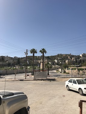
Bus station nearby Bet Romano
Israel
Bus station nearby Bet Romano
Bet Romano
West Bank
contacts phone
:
+972
Latitude:
31.524887
, Longitude:
35.105053
larger map & directions
read more
nearest Bus station
בית רומנו
Bus station
read more
227 m
Gross Square
Bus station
read more
227 m
כיכר גרוס
Bus station
read more
520 m
מערת-המכפלה
Bus station
read more
520 m
Me'arat Hamahpela
Bus station
read more
1.084 km
שדרות כלב בן יפונה/עמק חברון
Bus station
read more
1.096 km
Sd. Kaleb Ben Yefune/Emek Hevron
Bus station
read more
1.123 km
מועצה דתית
Bus station
read more
1.16 km
Commercial Center/Yehoshua Bin Nun
Bus station
read more
1.185 km
דוד המלך/יהושע בן נון
Bus station
read more
1.199 km
Sd. Kaleb Ben Yefune/Yehoshua Bin Nun
Bus station
read more
1.25 km
דוד המלך/שד. כלב בן יפונה
Bus station
read more
1.328 km
שד. כלב בן יפונה/גור אריה
Bus station
read more
1.345 km
שד. כלב בן יפונה/דוד המלך
Bus station
read more
1.468 km
נחל אשכול/גור אריה
Bus station
read more
1.564 km
Nahal Eshkol/3507
Bus station
read more
1.653 km
גור אריה/נחל אשכול
Bus station
read more
2.179 km
בסיס צבאי/כביש 3507
Bus station
read more
2.179 km
Military Base/Road 3507
Bus station
read more
2.212 km
קרית ארבע/3507
Bus station
read more
2.376 km
הרצי''ה קוק/יצחק טבנקין
Bus station
read more
2.505 km
הרצי''ה קוק/יוני נתניהו
Bus station
read more
2.512 km
Road 3507/Nofe Mamre Road
Bus station
read more
2.588 km
דרך נופי ממרא/3597
Bus station
read more
2.643 km
כיכר ממרא
Bus station
read more
📑
all categories
Accounting
Administrative area level 1
Administrative area level 2
Airport
Amusement park
Aquarium
Art gallery
Atm
Bakery
Bank
Bar
Beauty salon
Bicycle store
Book store
Bowling alley
Bus station
Cafe
Campground
Car dealer
Car rental
Car repair
Car wash
Casino
Cemetery
Church
City hall
Clothing store
Colloquial area
Convenience store
Country
Courthouse
Dentist
Department store
Doctor
Electrician
Electronics store
Embassy
Establishment
Finance
Fire station
Florist
Food
Funeral home
Furniture store
Gas station
General contractor
Grocery or supermarket
Gym
Hair care
Hardware store
Health
Hindu Temple
Home goods store
Hospital
Insurance agency
Intersection
Jewelry store
Laundry
Lawyer
Library
Light rail station
Liquor store
Local government office
Locality
Locksmith
Lodging
Meal delivery
Meal takeaway
Mosque
Movie rental
Movie theater
Moving company
Museum
Natural feature
Neighborhood
Night club
Painter
Park
Parking
Pet store
Pharmacy
Physiotherapist
Place of worship
Plumber
Point of interest
Police
Political
Post office
Premise
Real estate agency
Restaurant
Roofing contractor
Route
Rv park, camping
School
Shoe store
Shopping mall
Spa
Stadium
Storage
Store
Subpremise
Subway station
Supermarket
Synagogue
Taxi stand
Train station
Transit station
Travel agency
University
Veterinary care
Zoo
administrative area level 3
administrative area level 4
sublocality level 1
↑