Bar nearby יקב כפיר
Coronavirus disease (COVID-19) Situation
confirmed cases
4841772
deaths
12707
Israel
Bar nearby יקב כפיר
יקב כפיר
4, אלעזר, 7080000, גן יבנה, רחובות, IL ישראל
contacts phone
:
+972 8-857-1082
website:
www.kfir-winery.co.il
Latitude:
31.782502
, Longitude:
34.690114
larger map & directions
read more
nearest Bar
Kfir Winery
El'azar Street 4, Gan Yavne
Bar
read more
1.44 km
פאב הרצל
הרצל 41, גן יבנה
Bar
read more
1.44 km
Herzl Pub
Herzl Street 41, Gan Yavne
Bar
read more
2.339 km
בר כל
רבי ינאי 28, אשדוד
Bar
read more
2.339 km
בר כל
Rabbi Yanai Street 28, Ashdod
Bar
read more
3.728 km
Cavalo
Ha-Amal Street 41, Ashdod
Bar
read more
4.136 km
Base Bar - אשדוד
, מוהליבר, 1, Ashdod
Bar
read more
4.269 km
ביר סטיישן
הציונות 43, אשדוד
Bar
read more
4.269 km
Бир Стэйшн
Ha-Tsiyonut Street 43, Ashdod
Bar
read more
4.353 km
Castle
העצמאות 85, אשדוד
Bar
read more
4.446 km
Snooker Club G2
Ashdod
Bar
read more
4.446 km
Snooker Club G2
אשדוד
Bar
read more
4.467 km
דרינק פוינט אשדוד
הבנאים 2, אשדוד
Bar
read more
4.607 km
אקסנטו
HaOrgim Street 21, Ashdod
Bar
read more
4.645 km
נאפופו בר אשדוד
Ha-Tikshoret Street 8, Ashdod
Bar
read more
4.645 km
נאפופו בר אשדוד
התקשורת 8, אשדוד
Bar
read more
4.653 km
פיגאל
הבנאים 1, אשדוד
Bar
read more
4.717 km
לורנס בר אשדוד
הבנאים 10, אשדוד
Bar
read more
4.717 km
Lawrence Bar
HaBana'im Street 10, Ashdod
Bar
read more
4.871 km
cofix BAR
שדרות ירושלים 18, אשדוד
Bar
read more
4.871 km
Кофикс
Sderot Yerushalayim 18, Ashdod
Bar
read more
5.1 km
Burger Moo
Shavei Tsiyon Street 4, Ashdod
Bar
read more
5.708 km
GodA גודה
Martin Buber Street 1, Ashdod
Restaurant
Cafe
Bar
Food
Point of interest
Establishment
read more
5.712 km
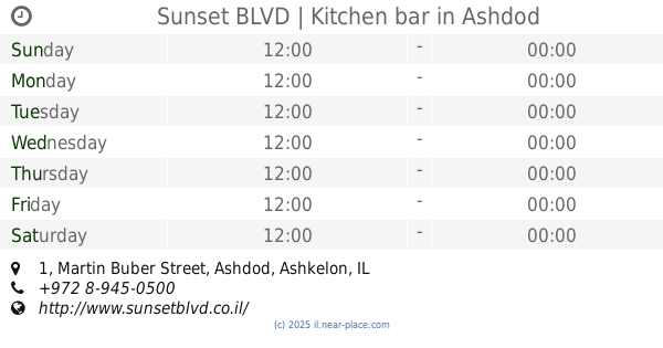
Sunset BLVD | Kitchen bar
Martin Buber Street 1, Ashdod
Bar
Restaurant
Food
Point of interest
Establishment
read more
5.719 km
יין
מרטין בובר 1, אשדוד
Bar
read more
📑
all categories
Accounting
Administrative area level 1
Administrative area level 2
Airport
Amusement park
Aquarium
Art gallery
Atm
Bakery
Bank
Bar
Beauty salon
Bicycle store
Book store
Bowling alley
Bus station
Cafe
Campground
Car dealer
Car rental
Car repair
Car wash
Casino
Cemetery
Church
City hall
Clothing store
Colloquial area
Convenience store
Country
Courthouse
Dentist
Department store
Doctor
Electrician
Electronics store
Embassy
Establishment
Finance
Fire station
Florist
Food
Funeral home
Furniture store
Gas station
General contractor
Grocery or supermarket
Gym
Hair care
Hardware store
Health
Hindu Temple
Home goods store
Hospital
Insurance agency
Intersection
Jewelry store
Laundry
Lawyer
Library
Light rail station
Liquor store
Local government office
Locality
Locksmith
Lodging
Meal delivery
Meal takeaway
Mosque
Movie rental
Movie theater
Moving company
Museum
Natural feature
Neighborhood
Night club
Painter
Park
Parking
Pet store
Pharmacy
Physiotherapist
Place of worship
Plumber
Point of interest
Police
Political
Post office
Premise
Real estate agency
Restaurant
Roofing contractor
Route
Rv park, camping
School
Shoe store
Shopping mall
Spa
Stadium
Storage
Store
Subpremise
Subway station
Supermarket
Synagogue
Taxi stand
Train station
Transit station
Travel agency
University
Veterinary care
Zoo
administrative area level 3
administrative area level 4
sublocality level 1
↑