Atm nearby صراف آلي _ البنك العربي
Coronavirus disease (COVID-19) Situation
confirmed cases
4841772
deaths
12707
Israel
Atm nearby صراف آلي _ البنك العربي
صراف آلي _ البنك العربي
C328+MQ2, Samu'a
contacts phone
:
+972
website:
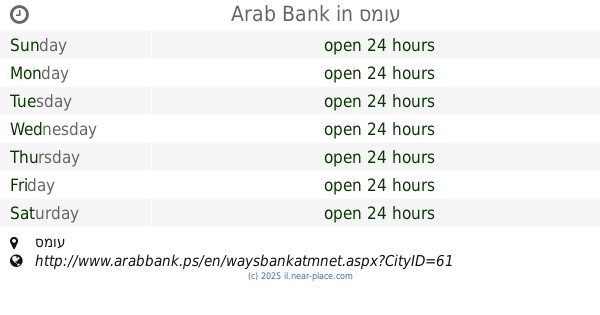
www.arabbank.ps
Latitude:
31.4016437
, Longitude:
35.0668791
larger map & directions
read more
nearest Atm
Arab Bank
as-Samu
Atm
read more
صراف آلي _ البنك العربي
as-Samu
Atm
read more
15 m
صراف الي بنك فلسطين -السموع
Samou Street
Atm
read more
16 m
صراف بنك فلسطين -بلدية السموع
بلدية السموع
Atm
read more
5.202 km
Bank of Palestine ATM
Samou Street
Atm
read more
14.682 km
בנק מרכנתיל
שדרות המייסדים, מיתר
Atm
read more
16.872 km
כספומט בנק הדואר
אלבוראק 5, חורה
Atm
read more
16.872 km
כספומט בנק הדואר
Alburak Street 5, Hura
Atm
read more
23.399 km
KHARAS ATM
Kharas-municipality street 354، Kharas
Atm
Finance
Point of interest
Establishment
read more
24.642 km
ATM - Leumi Bank
Lehavim
Atm
Finance
Point of interest
Establishment
read more
24.644 km
Банк Леуми
Lehavim
Atm
read more
24.644 km
כספומט בנק לאומי
להבים
Atm
read more
24.669 km
ATM Bank Hapoalim
Lehavim
Atm
read more
24.669 km
כספומט בנק הפועלים
להבים
Atm
read more
24.684 km
כספומט
Lehavim
Atm
Finance
Point of interest
Establishment
read more
26.357 km
ATM
Tel as-Sabi
Atm
read more
26.357 km
כספומט
תל שבע
Atm
read more
28.975 km
ATM
Be'er Sheva
Atm
read more
29.009 km
כספומט
Yehuda ha-Nakhtom Street 8-10, Be'er Sheva
Atm
read more
29.225 km
כספונט
Wingate Street 3, Be'er Sheva
Atm
Finance
Point of interest
Establishment
read more
29.225 km
כספונט
וינגייט 3, באר שבע
Atm
read more
29.678 km
כספומט פועלים
Be'er Sheva
Atm
read more
29.678 km
כספומט פועלים
באר שבע
Atm
read more
30.159 km
כספומט
Sderot Shazar 33, Beersheba
Atm
Finance
Point of interest
Establishment
read more
59.851 km
כספומט נאפיס
הבנאים 2, אשדוד
Atm
read more
📑
all categories
Accounting
Administrative area level 1
Administrative area level 2
Airport
Amusement park
Aquarium
Art gallery
Atm
Bakery
Bank
Bar
Beauty salon
Bicycle store
Book store
Bowling alley
Bus station
Cafe
Campground
Car dealer
Car rental
Car repair
Car wash
Casino
Cemetery
Church
City hall
Clothing store
Colloquial area
Convenience store
Country
Courthouse
Dentist
Department store
Doctor
Electrician
Electronics store
Embassy
Establishment
Finance
Fire station
Florist
Food
Funeral home
Furniture store
Gas station
General contractor
Grocery or supermarket
Gym
Hair care
Hardware store
Health
Hindu Temple
Home goods store
Hospital
Insurance agency
Intersection
Jewelry store
Laundry
Lawyer
Library
Light rail station
Liquor store
Local government office
Locality
Locksmith
Lodging
Meal delivery
Meal takeaway
Mosque
Movie rental
Movie theater
Moving company
Museum
Natural feature
Neighborhood
Night club
Painter
Park
Parking
Pet store
Pharmacy
Physiotherapist
Place of worship
Plumber
Point of interest
Police
Political
Post office
Premise
Real estate agency
Restaurant
Roofing contractor
Route
Rv park, camping
School
Shoe store
Shopping mall
Spa
Stadium
Storage
Store
Subpremise
Subway station
Supermarket
Synagogue
Taxi stand
Train station
Transit station
Travel agency
University
Veterinary care
Zoo
administrative area level 3
administrative area level 4
sublocality level 1
↑